Cádiz - Today
last update: 20 Nov. 2019
We are going to start with the excellent description of Cádiz provided by Wikipedia. It tells us that Cádiz is a city and port in southwestern Spain, and that it is the capital of the Cádiz province, one of the eight provinces that make up the autonomous community of Andalusia.
We are also told that Cádiz is the oldest continuously inhabited city in Spain and one of the oldest in western Europe. There is substantial evidence that the site was occupied in 800 BC by the Phoenicians, and it has been suggested that the city was originally called Gádir and might have been established more than 3,000 years ago. Traces of Phoenician settlements have also been found in El Puerto de Santa María and Chiclana de la Frontera (they naturally dispute the original site of Gádir).
Cádiz has also been the principal home port of the Spanish Navy since the accession of the Spanish Bourbons in the 18th C.
Wikipedia goes on to tell us that despite its unique site on a narrow slice of land surrounded by the sea‚ Cádiz is, in most respects, a typically Andalusian city with a wealth of attractive vistas and well-preserved historical landmarks. I would (to some degree) dispute this analysis. Attractive vistas, certainly. Historical landmarks, certainly. Well-preserved, I’m not so sure. They are certainly fighting the decay, but sometimes it looks like a battle they just can’t win.
The older part of Cádiz within the remnants of the city walls is commonly referred to as the Casco Antiguo (a pre-19th C town centre). It is characterised by the antiquity of its various quarters (barrios), which present a marked contrast to the newer areas of the city. Some of the oldest barrios are El Mentidero, El Balón, El Pópulo, La Viña, and Santa María. While the old town's street plan consists of narrow winding alleys connecting to small plazas, newer areas of Cádiz typically have wide avenues and more modern buildings. Wikipedia is quite right to note that the city is also dotted with numerous parks where exotic plants flourish, including giant trees supposedly brought to Spain by Columbus from the New World.
Cádiz Today
Today Cádiz, despite being the capital of the province, is only about half the size of Jerez de la Frontera (approx. 120.000 vs. 220,000), and it is only just a bit bigger than Algeciras (see list of municipios). But it is still the 17th largest city in Spain. However the city is shrinking in favour of the residential-tourism towns nearby, e.g. Chiclana de la Frontera, El Puerto de Santa Maria, Puerto Real, Rota, and San Fernando.
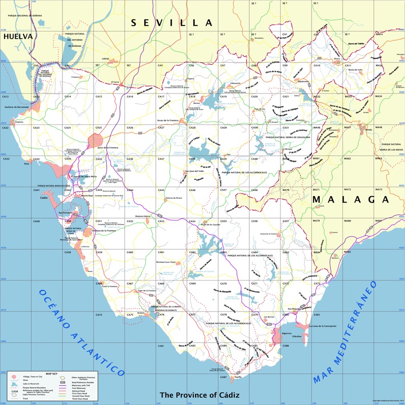
Below we can see the extent of the province of Cádiz, bordering on the provinces of Huelva, Sevilla, and Málaga. And of course we can see the Atlantic Ocean, the Mediterranean Sea and the Estrecho de Gibraltar.
We drove into Cádiz using the South motorway, passing through San Fernando, that was once known simply as La Isla (The Island). We passed by some of the most important beaches in Spain (e.g. Playa de Composoto, Playa de la Victoria).
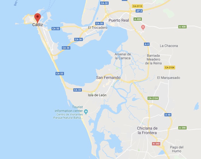
When we visited Cádiz in 2014 the new bridge (see CA-35) to the city was not yet opened (we will visit it late on this webpage). In fact on this map we took the CA-33 from San Fernando and not the CA-36 from Puerto Real. In fact today access is also possible from Puerto Real by the CA-35 over the new bridge.
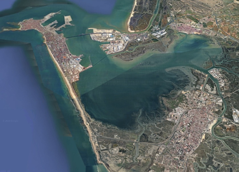
We then drove right through the newer part of Cádiz towards the old town, along the ocean side. In the below map we can see the 'new' Cádiz to the right (East), and the old town to the left (West). The route into the old town and to our hotel (the local Parador) took us in a clockwise direction around the South and West side of the old town. The ‘natural’ traffic flow looks to be along the South, or Atlantic side, around the old town in the clockwise direction, and back towards the East through the new Cádiz using the central boulevard.
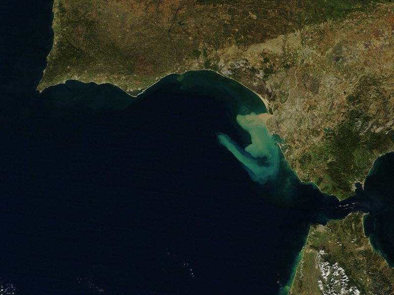
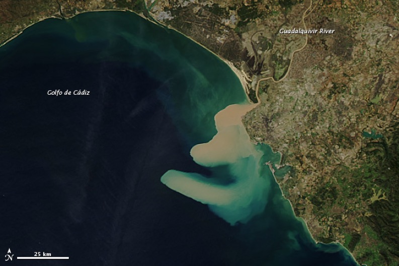
Below we are going to look at Cádiz from a different perspective. Certainly one important element in the history of the city was when it replaced Sevilla as the home of the Spanish treasure fleet. In fact in the 18th C the sand bars of the Guadalquivir forced the Spanish government to transfer its American trade from Sevilla to Cádiz. What we are seeing below is a recent example (2012) of the way the Guadalquivir became unnavigable. A heavy load of thick sediment was dumped into the Gulf of Cádiz (the colours are natural), and you can see the impact of the strong and complex currents in the region.
Now we have a few arial views of the drive into Cádiz. So we used the CA-33 and drove past San Fernando and the Isla del León to get to the Atlantic Coast. Here we turned at a place I think was called Torregorda and we saw the first beach-dunes. According to some maps the beach is called Playa de Torregorda, but according to the official list of managed beaches in region this does not exist. I presume this just means that it is not officially a beach (although there are plenty of photographs of people using it like a beach).
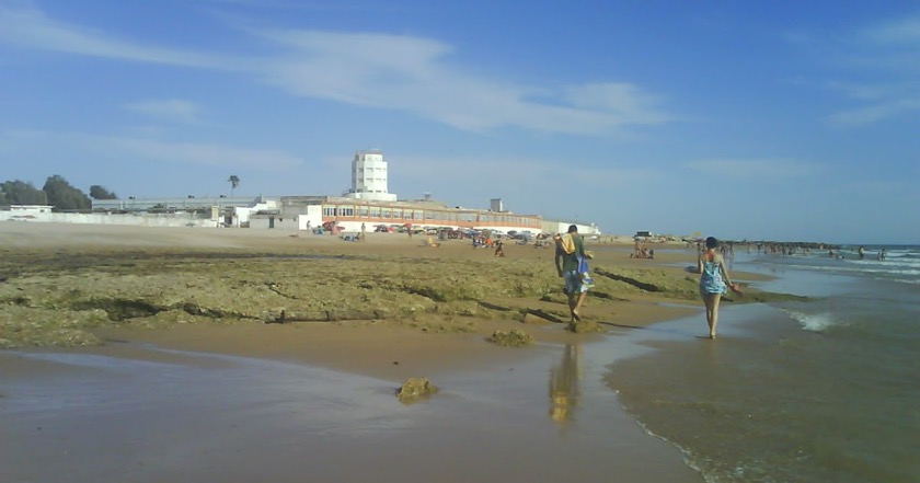
We can see a white tower. According to Wikipedia this was originally a 17th C tower possible built on the remains of earlier observation and signalling towers. The older tower was demolished in 1898, but a new tower was built on the site in 1932. Apparently from 1805 to 1820 the tower was home to a military optical telegraph (like a semaphore telegraph), and from 1850 to 1857 is was a civil optical telegraph but according to a different principle. A certain brigadier Mathé installed a mobile sphere that indicated a numerical code, which was repeated from tower to tower by observing the codes using an achromatic telescope. I've read that Torregorda is (or was) a military base dedicated to shooting practice, and that the beach was at one time reserved for military and family members.
I'm not sure but I think that the authorities have had all the permanent chiringuito's removed from the beaches, but each year some get the permission to build temporary ones just for the summer season.
As far as I can see almost every practicable exist from the CA-33 leads to an official or unofficial beach. The next one along the road is Playa de Santibañez, which I've read is a nudist beach, but checking this out was not on our tourist agenda (also a gay nudist beach). I've also read that it is the preferred beach for surfing.
Interestingly the above photograph Playa de Santibañez was associated with a comment about the Via Augusta which (according to Wikipedia) was the longest and busiest Roman Road linking Cádiz to the Pyrenees, and then on to Rome. The road would have had to take the route of the dunes leaving Cádiz (Gades) for El Puerto de Santa Maria (Portus Gaditanus). It then went on to Rota (Rotes), Jerez de la Frontera (Asta Regia), Séville (Hispalis) before ending in Narbonne (Narbo Martius).
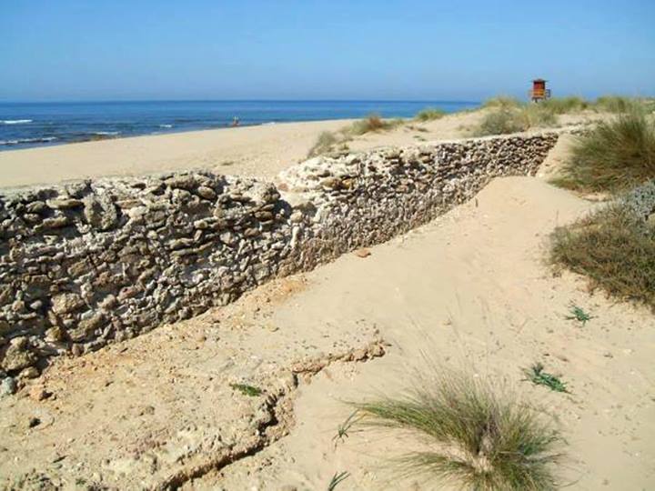
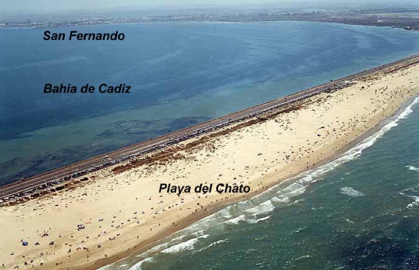
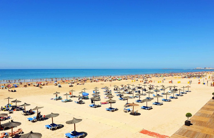
Next is the better known Playa del Chato, and then we arrive in the new part of Cádiz with the long Playa de Cortadura.
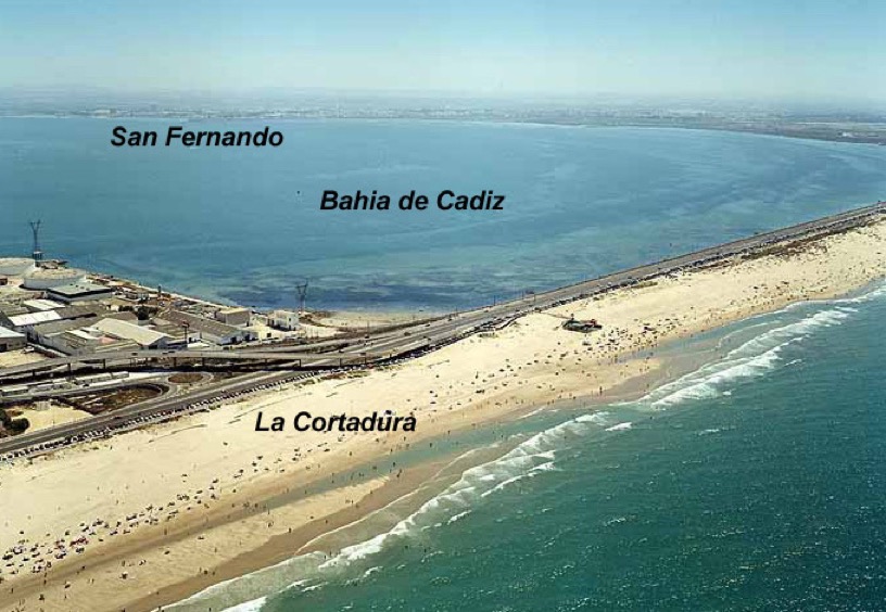
Beyond La Cortadura we hit the built-up area we have the Playa de la Victoria, a tourist beach about 3 kilometres long. This is the principle beach for the holiday hotels in Cádiz, but all the other resort areas nearby have their own beaches as well.
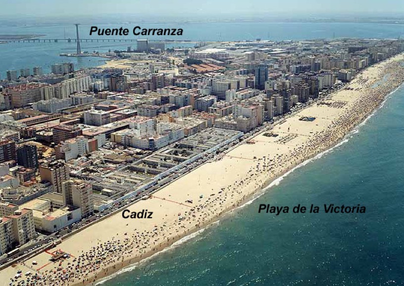
As an extension of Playa de la Victoria and before entering the old town we also have the Playa Santa Maria del Mar.
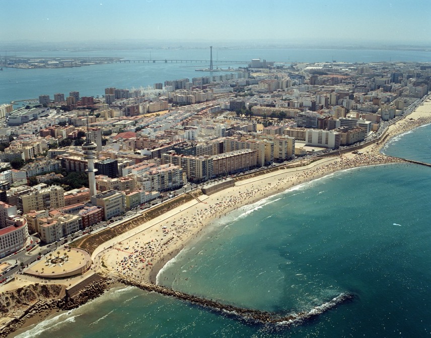
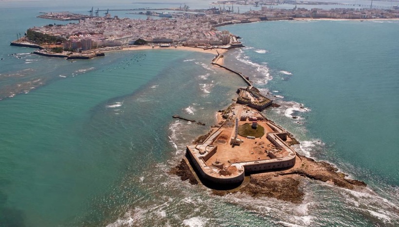
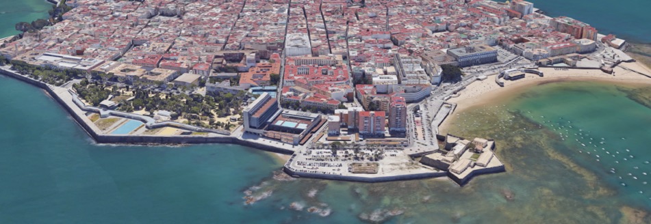
As we approach the old town in the distance on the left we can just about see the Playa de la Caleta, and just in front of it, sticking out into the Atlantic Ocean, the Castillo de San Sebastián.
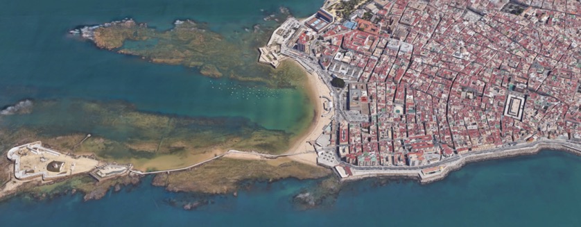
It is said that La Caleta is unusual in that each of the major stones on the beach have names, e.g. la piedra cuadrá (the quadratic stone), la piedra reonda (the reonda), la palangana (the stone basin), la piedra del erizo (the hedgehog), la puntilla (the lace), la laja (the slab), etc.
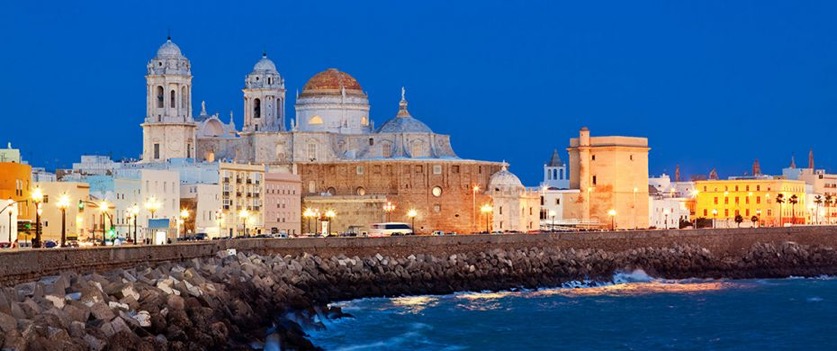
Below we can see the old town from the other side. In front of us we have the Playa de la Caleta, and we can see the walkway to the Castillo de San Sebastián sticking out into the Atlantic Ocean. To the left of the Playa de la Caleta we have the Castillo de Santa Catalina, and a little further left the Parque Genovés. We can also see next to the Parque Genovés the new Parador. And over the back we can just see the port of Cádiz.
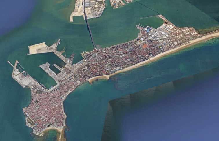
The Port of Cádiz
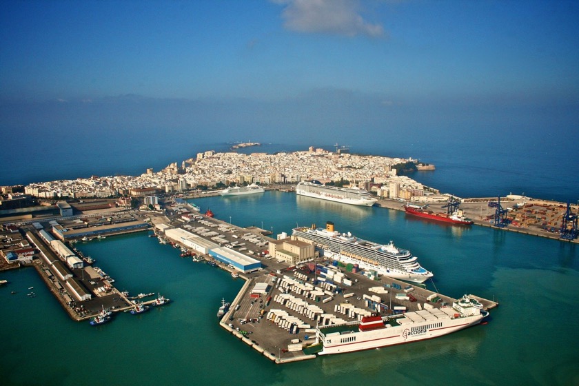
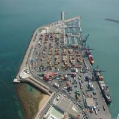
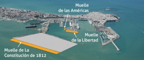
Above we have a view of the port of Cádiz. In the distance we can see the Atlantic Ocean, and to the right we can just see the container terminal (dock called Muelle Reina Sofia) with two of the three 40 ton blue gantry cranes used to move containers from ship-to-shore and shore-to-ship (they look like classical Panamax cranes). This dock can accept ships having up to 400 meters overall length, and we can see a red container ship moored next to a cruise liner. Moving anti-clockwise we can see a smaller cruise liner moored at the dock called Muelle Alfonso XIII which has its own cruise terminal and can accept ships with an overall length of up to 324 meters. Then you can see a much smaller cruise liner moored at the dock called Muelle Ciudad which can accommodate ships with an overall length of 316 meters. As we move around to the very large cruise liner moored at the dock Muelle Marques de Comillas we have the unoccupied dock called Muelle Reina Victoria (maximum overall length of 220 meters). The Muelle Marques de Comillas can accommodate ships with an overall length of 625 meters, and it also has three loading ramps that can each accept 100 ton loads.
In front of us we have a ferry moored at the dock called Muelle de la Libertad, which is able to accommodate ships with an overall length of 304 meters, and it is also equipped with one ramp able to accept loads up to 100 tons (so-called RO-RO or “roll-on/roll-off”). These ferry’s are operated by Trasmediterranea Acciona, and run between Cádiz and Arrecife (Lanzarote), Las Palmas (Gran Canaria), Santa Cruz de La Palma, and Santa Cruz de Tenerife. As we move round to the shallower Dársena Pesquera (fishing basin) we can see firstly the Muelle Las Américas (110 meters with one 100 ton loading ramp) and the Muelle Diego Fernando Montañés (about which I can find no information), both unoccupied.
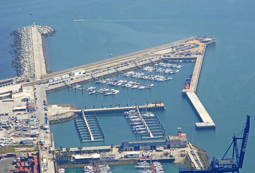
To the very right of the container terminal there is the Real Club Náutico and the Puerto America (we can just see the blue Crain of the container terminal). The Real Club Náutico can accommodate 182 boats in the 6-14 m overall length. However almost all the berths are occupied, so visitors must go next door to the Puerto America which has another 270 births.
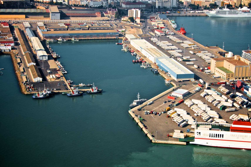
To the left of the ferry dock is the Dársena Pesquera, with docks and fishing services (we can just see the red funnel of the ferry). This area has a total dock length of 910 meter over three docks, firstly Muelle G.Fernández Ladreda, then the Muelle Nueva Lonja, and finally the Muelle de Levante. These docks include warehouses and cold stores.
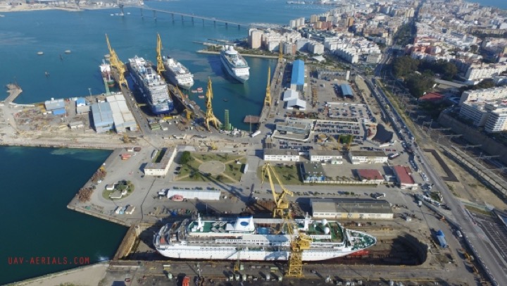
On the other side of the Muelle de Levante we also can see Muelle Duques de Alba in the so-called Dársena Dique Seco (dry dock basin). We can see just a hint of the Muelle Embocadura and the entry point to the Dique Seco V. del Rosario.
Before moving on we have on the left another view of the existing container terminal and behind that the Real Club Náutico and then the Puerto America.
Now we have below another view of the port. We can see the existing container terminal and the two leisure ports to the right. More or less in the middle we can see the Dársena Commercial and the Dársena Pesquera (the commercial and fishing waterfronts). And to the left can see the Dársena Dique Seco (the dry dock waterfront) with the 'small' indented entrance to the Dique Seco V. del Rosario.
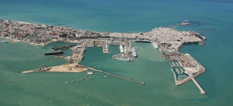
For the first time we can see the extent of the docks in Cádiz and we immediately realise that they dwarf the actual old town (little 'white' area on top right).
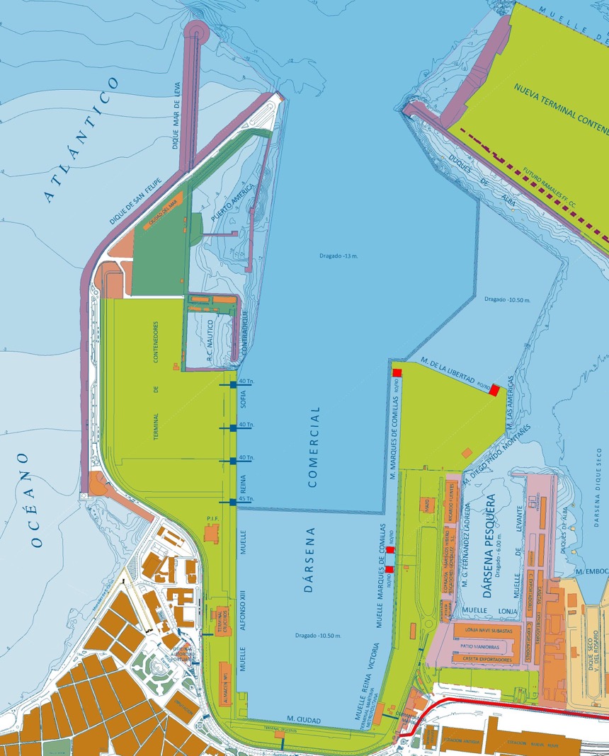
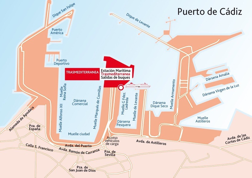
Below we have two plans of the port, the first is from the port authority and the second from the ferry company.
Returning to the end of the port on the right, we can see some major earthworks.
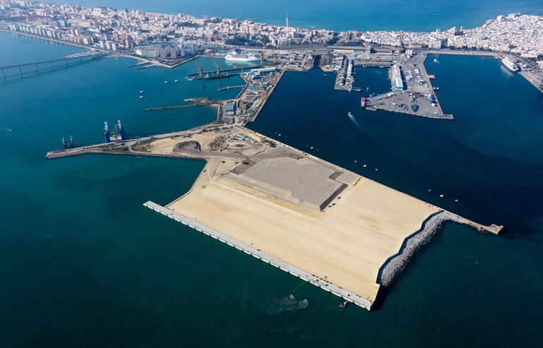
What I’m not sure about is the actual state of development of these works. Originally there was a pier named Duques de Alba on the left side and Dique de Levante on the right. In the corner there was a cleaning and degassing station. This station was removed, and two additional piers or retention walls built, almost closing off a large surface clearly still partially under water. This is going to be a new container terminal (or perhaps has become). There had been talk about expanding the commercial operation of the port for sometime. It was suggested to also move the smaller dry dock Virgen del Rosario, to build a train tunnel for container traffic, and to separate commercial and cruise traffic. I’m not sure any of these 'additional' suggestions were retained in the final project.
In fact a new container terminal is being built with a €60 million loan from the European Invest Bank (EIB). Or more precisely the first phase, including a new quay, the reclamation of ground for the new terminal area, the dredging of the access channel, and a new internal access road (including a 1 km tunnel). An additional €60 million funding is provided by the European Regional Development Fund, and the region itself will provided the remaining 13% of the total cost. This is a bit odd since the total cost of the project was estimated at €118 million. But the project was originally estimated at €90 million, so who knows what the final cost will be.
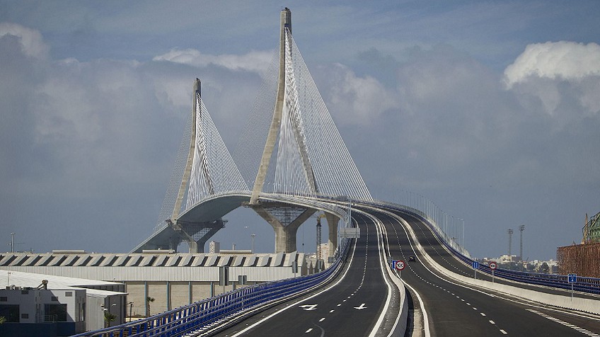
And we should not forget the new bridge I mentioned earlier. This additional 5 km long bridge joining Cádiz to the mainland is costing €500 million (funded by the federal government). Clearly the bridge is right next door to the new container terminal. This is going to be quite useful for lorries, but having more cars flowing into a 'island' city with an impossible parking problem appears less than inspired. Still I’m told it is the highest such structure in Europe and the middle section can be opened to allow mega-ships to sail into the bay.
In addition to the port of Cádiz there is also the ports of Zona Franca (containers, ferries, and bulk solid and liquids), Cabezuela-Puerto Real (bulk solid and liquids, ferries, fishing, leisure), and el Puerto de Santa María (which has a very limited access depth but which can handle containers, bulk solid and liquids, fishing and small passenger boats). And as a final twist we also find that the EIB and the EU are also funding both improvements to the container terminal and port in Sevilla and the dredging of the Guadalquivir. And not forgetting that a short drive away you also have one of Europe’s busiest container ports in Algeciras. Do these investments look sensible? I’ll let you decide.
In any case it would appear that there are a number of complaints and corruption charges open, and at the present moment funding is either blocked or is flowing drop-by-drop (as of 2014).
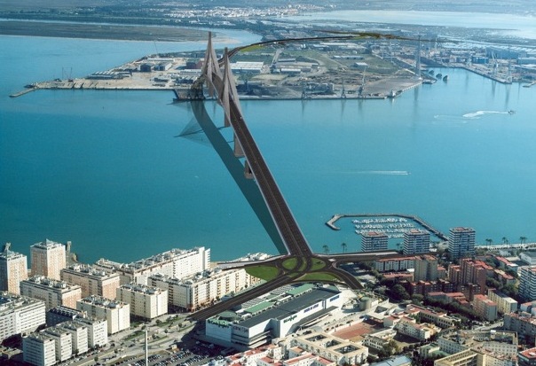
In the El Corte Ingles shopping centre we could see the new bridge, La Pepa, being built in front of our eyes. The new bridge ‘lands' right in front of the main entrance to the shopping centre.
Back to the old Cádiz
The “Tacita de Plata” (one old nickname for the city) is considered the oldest city in the Western World. It was founded (possibly as early as 1100 BC) by the Phoenicians, a seafaring people who turned Gadir into an important trading colony where the Carthaginians, the Romans, the Visigoths and the Muslims would all subsequently settle. An open, cosmopolitan city, its port was chosen by Columbus as the point of departure for his second voyage to the New World. The city would then become, after the decline of Seville, the port to The Americas, hosting trade with the American Continent. This frantic commercial activity brought about an era of economic and cultural splendour, when Baroque palaces were built each with their characteristic towers offering amazing views out to sea.
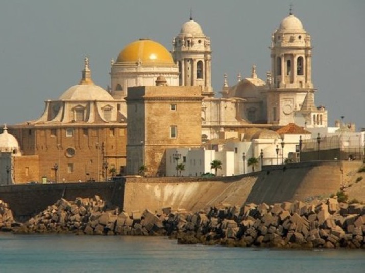
The Cathedral, which can be seen from the sea, with its golden tiled dome fits perfectly into the Cádiz cityscape with its colonial air. It combines both the Baroque and Neoclassical styles, and its treasure is amongst the most important in Spain.
The intense trading activity with The Americas awakened the greedy interest of pirates, which led to the city being fortified. The remains of the original cross-fire defense wall designed by Vauban makes up an important part of the heritage of Cadiz. Las Puertas de Tierra, the city gates, retain sections of walls and semi-bastions. A stroll along Campo del Sur affords the visitor a view of the Los Mártires and Capuchinos defence bastions. And the Playa de la Caleta, in the old city, is also guarded by the San Sebastián and Santa Catalina fortresses.
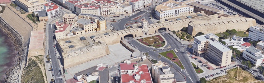
The only way into the old Cádiz is through the Puertas de Tierra, part of the original defences build in the 18th C. The historic centre of the city has narrow streets and small squares set out in a series of barrios.
We need to move on and have a look at how the city is divided up in to the different barrios. Today the casco histórico (old city) is made of the four historically well known and well defined barrios, i.e. San Juan, La Viña, El Balón, and El Mentidero. In addition we also have two barrios called El Pópulo and Santa María that look over the Atlantic Ocean and the Bahía de Cádiz. And there is a barrio Centro (city center) and a barrio San Carlos towards the estaciôn maritimo.
We do not intend to describe the complete evolution of the city centre, but it is useful to look at how the different barrios have change over time.
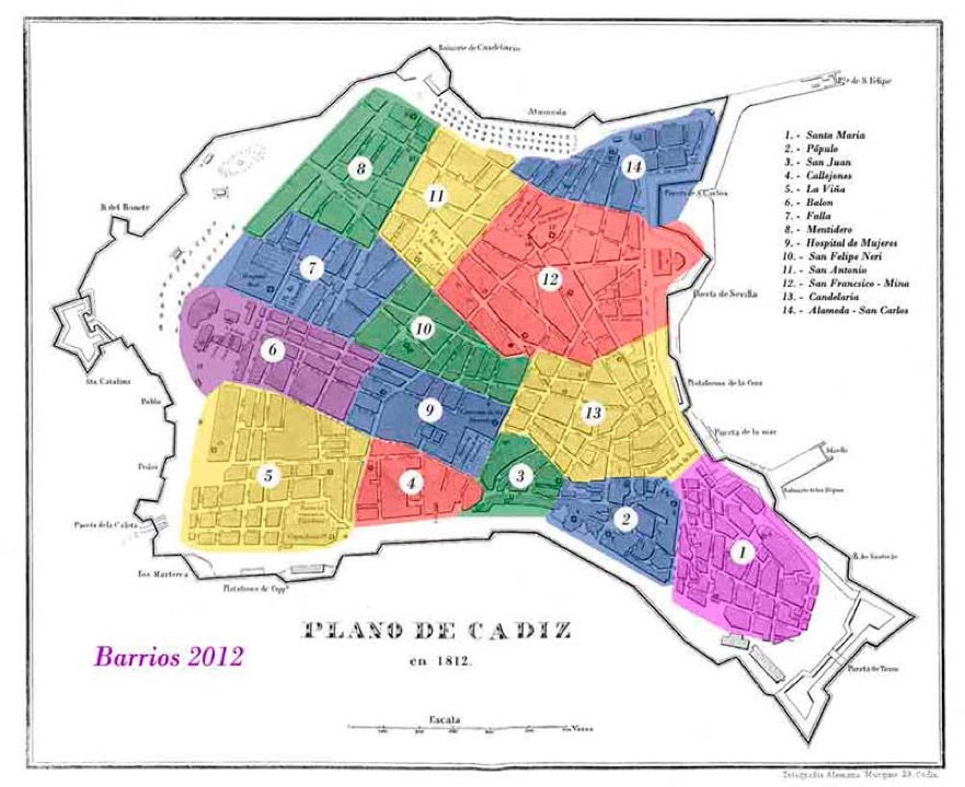
Throughout the 19th C the names and extent of the different barrios changed, and they only started to be “standardised” late in the 19th C. Also the urban area of Cádiz extended beyond the city walls, but these people were just called extramuros. In 1868 the city was divided into quarteles, each with its own internal ‘government' and police, and each was divided into smaller barrios. The quarteles were called Santa Cruz (including San José), Roasario, San Antonio and San Lorenzo. And the barrios were at that time called Escuelas, Pópulo, Merced, San Carlos, San Francisco, Correo, Constitución, Hérclues, Cortes, Las Palma, Hospicio, and Libertad. The last two were the most popular, but the rich and powerful lived in San Carlos, San Francisco, Correo, Constitución, and Cortes. The poorest barrios were Las Palma, Hospicio, and Merced (and of course the extramuros).
In those days Cádiz still depended upon many small orchards (huertas) that had slowly been united into cottages and country estates (casas de campo y residencias). So for the richer land-owner the house in the city centre was often used just for weekends and holidays, thus the importance of gardens and open spaces. The extramuros would come into the city for the coffeehouses, shops and taverns (cafetines, ventas y tabernas) that opened around the city gates (puertas). So the barrios nearest the city gates housed mostly farm workers (trabajadores del campo). In 1865 almost half the population of Cádiz were farm workers. Another 20% were workers paid on a day-by-day basis (tanners, potters, millers, moulder’s and finisher’s in the iron foundry’s, those making and selling food and wine, and shop-workers). The rich were buying their houses in the better barrios, but throughout the 19th C it was relatively easy to move from one part of the city to another. Everyone tried to move nearer to the centre and to buy entire 3-floor houses for their extended families. Those families who wanted to stay in the same barrio, moved to the wider through streets.
For example the barrio La Palma was newly built in the 18th C (it was often also called the barrio del Mundo Nuevo) and from 1749 it started to build into the older barrio Hospicio. Both were “poorer” because of the humidity, but houses were lower, streets slightly wider, and they ‘let-in’ more sun. With time this barrio became attractive to both the richer professional and civil servants. Another barrio, La Merced, was home to sailors and fishermen, as well as carpenters, shoemakers and daily workers. This barrio would slowly join with the another antigua barrio, the Pópulo. And with time it would also attract a few important and rich owners, even as it became an ‘exotic’ mix of taverns, wine cellars and English slave owners (already installed in the barrio in the late 17th C). Also over time the barrio La Palma also became integrated in to the barrio we know today as El Pópulo. This barrio still retains the three gates to the original medieval city: El Pópulo, De la Rosa and De los Blancos Arches, as well as the Roman Theatre and the one-time Cathedral, Santa Cruz Church (before the new Cathedral was built).
It is possible to look at almost any early barrio and see how it evolved (or was absorbed) into those we know today. To close this part we will just mention the most obvious changes. Originally the richest barrios were San Carlos, San Francisco, Correo, Constitución, and Cortes. Today the old San Carlos, San Francisco, Correo, and Constitución (along with a bit of Hérclues) are all now known as the barrio San Carlos.
The end result of these changes was that the barrio San Carlos, the most protected from the winds, became the richest (and to a lesser degree this is also true for the barrio Bálon). The poorest, or most popular, barrios were those most open to the Atlantic ocean, e.g. El Populo, San Juan and La Viña.
As a last stop-over on this page we are going to visit the beaches of the new Cádiz, as opposed to the old Cádiz. Outside the walls of the old city you have a long thin ‘island’ of sand which was once called (I think) Isla de San Pedro. This is now considered by many visitors as Cádiz, and the old city is seen just as a nice tourist attraction for a day trip. This part of Cádiz is a 3-4 km long Atlantic coast beach, considered one of the best urban beaches in Europe.
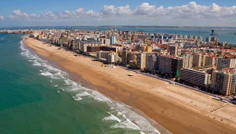
The origin of these holiday beaches was set in the economic depression following the loss of the last of the Spanish colonies. It started with the building in 1907 of a spa where the not-so-rich could also “take the waters”. Despite the fact that the beach front is well serviced by hotels, this area, compared to placed like Chiclana, it still not well know outside the region.